I show you some good views of Japan.


Cherry blossum blooms at the end of March.
I show you some good views of Japan.
Cherry blossum blooms at the end of March.
Hokkaido
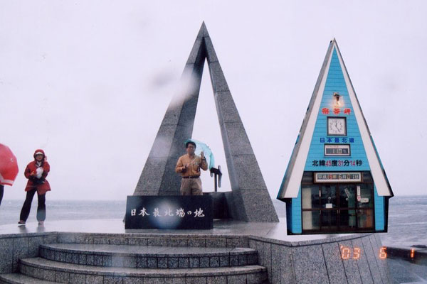
Soya peninsula, the northern-most point of Japan. About 50km south of Sahalin.
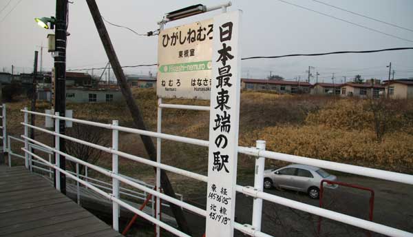
The eastern-most railway station of Japan; Higashi-Nemuro. Long; 145º 36' 05'', Lat; 43º 19' 18''
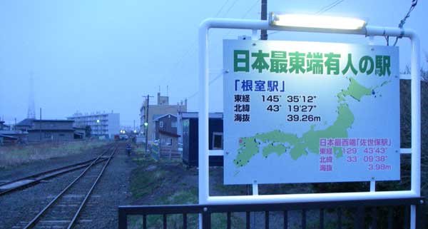
JR Nemuro station.
Nossapu peninsula, the eastern-most point of Japan. A few miles west from Russia.

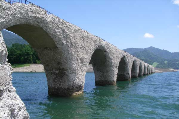
Tausyubetsu arch bridges.

Momoiwa (the peach rock) at Rebun island.

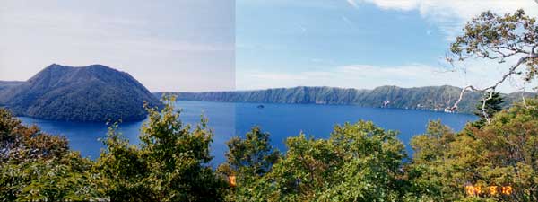
Lake Masyu (from the view point of the Ura-Masyu)
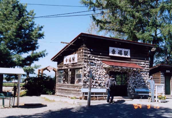
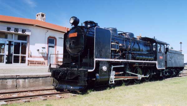
Koufuku (Happyness) former JR station.
Aikoku (Patriot) former JR station.
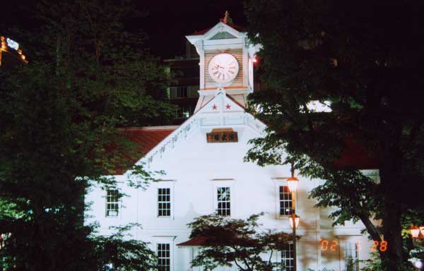
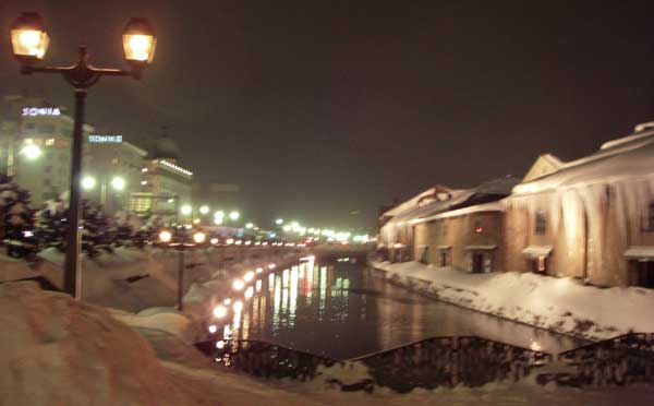
Otaru

Winter day, the temp is -7C.
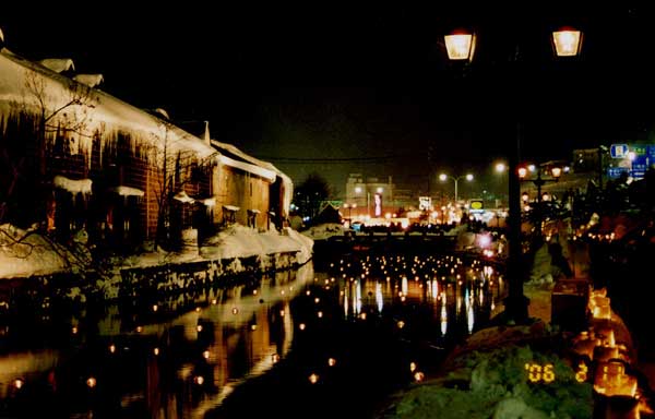
Otaru channel at Candle festival.
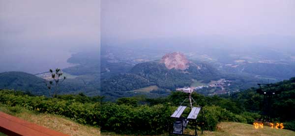
Showa new mountain & lake Toya from Mt. Usu.
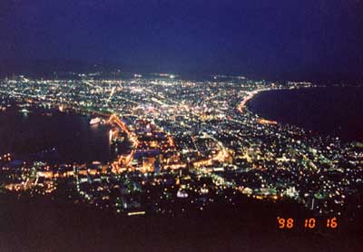
Night view from Hakodate-yama.
Hakodate located most south part of Hokkaido.
Tohoku
Oze
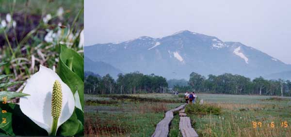

About 100m of fall looks cool.
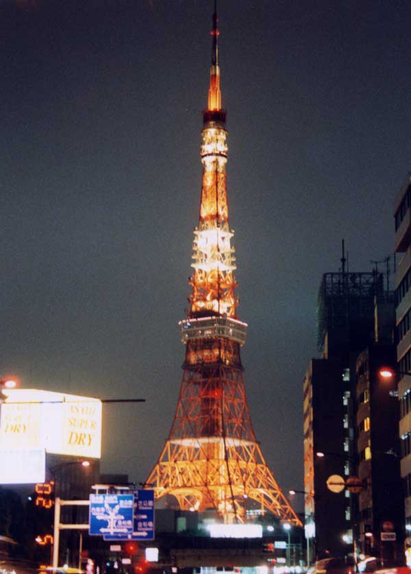
Tokyo tower
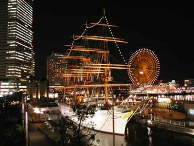
Nippon-Maru.
Intercontinental hotel Yokohama and The Landmark Tower.
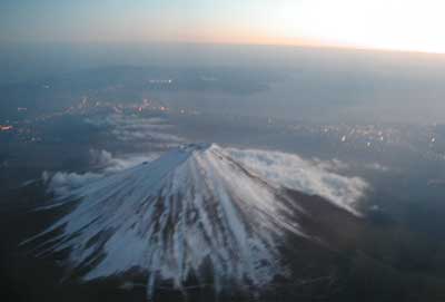
Chuubu
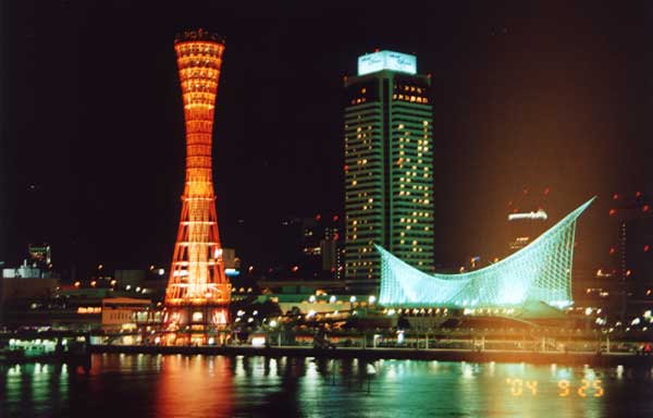
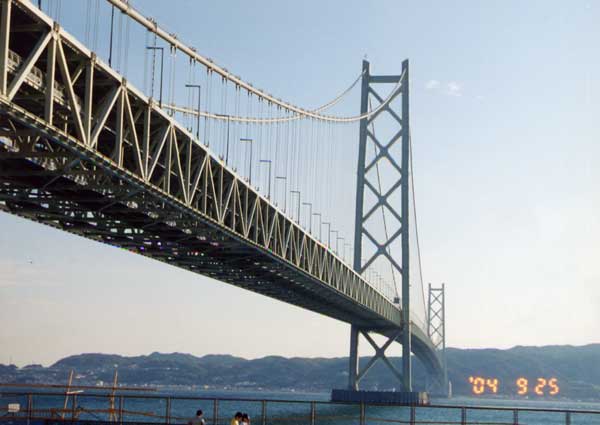
Kinnki
Kobe at nighit, with Kobe Tower.
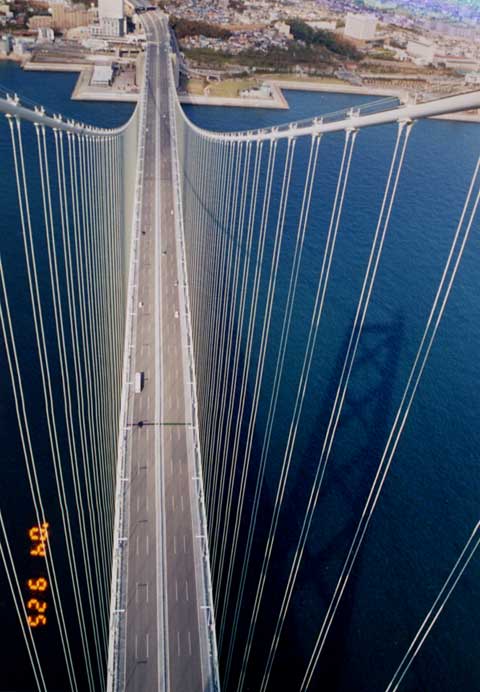
Akashi Suspension Bridge, the longest bridge of the world which span length 1991m.

Now! we were start to climb the top of the tower at 297m high!
We went this maintenance route, which is prohibited to the public except this tour.
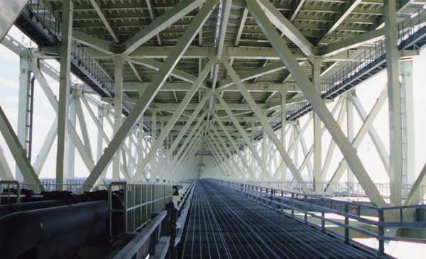
Using elevetor to the top of the tower, you can see,,,,,
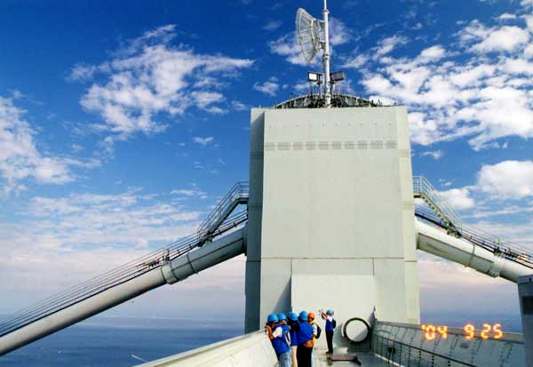
For North, Akashi side.
For the South, Awaji island side.


This iron train bridge was built in 1912.
This bridge is not only the oldest iron bridge in Japan
but also the highest from the grond of 42m high.
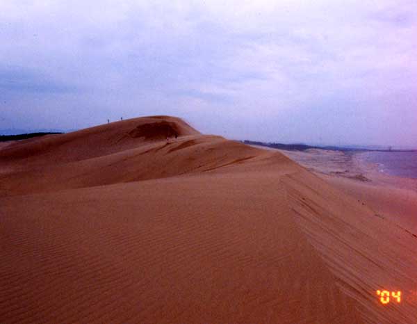
Tottori sand dune
Shikoku
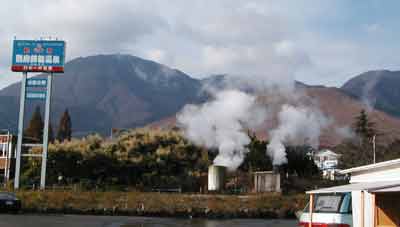
Beppu springs formed around this volcano.
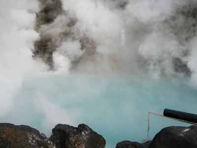
Sea hell. Blue hot water spring.
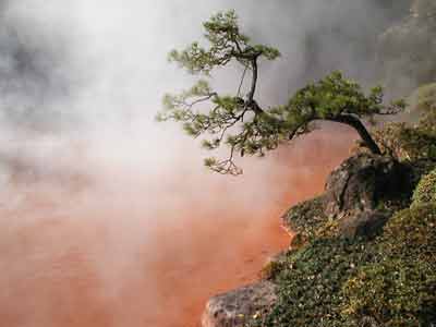
Bloddy hell. Fero-Oxide makes red color.
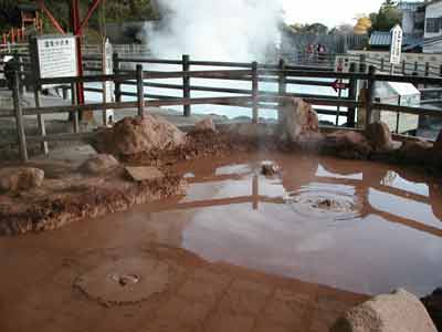
Steam hell. The colors are very different in the small area.
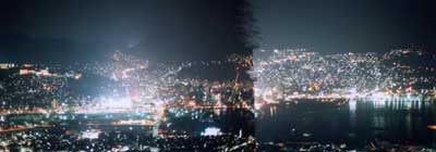
Nagasaki night view from Inasayama (west) to east.
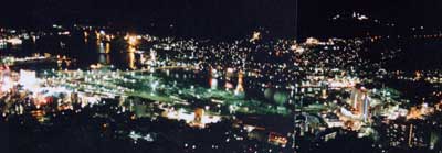
Nagasaki night view for Inasayama (west view).

Spectacles bridge.
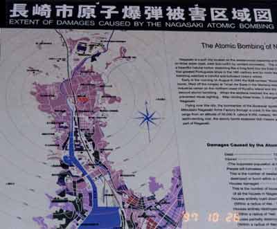
An atomic bomb exploded over Nagasaki on August 9, 1945,
three days after the atomic bombing of Hiroshima.
The bomber "Bockscar" flown to Nagasaki and dropped the bomb
from an altitude of 9,000 meters.
A plutonium bomb much more powerful than the uranium Hiroshima-type bomb,
the device exploded about 500 meters over Matsuyama-machi neighborhood
in the northern part of Nagasaki, killing or injuring 150,000 people
and leaving a third of the city area in ruins.
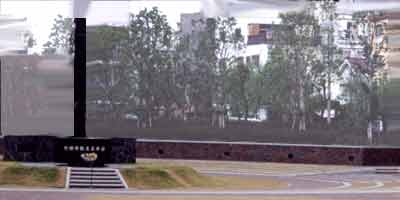
This is the place where the plutonium bomb exploded.
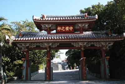
Syurei gate. This gate was desined to the 2000yen bill.
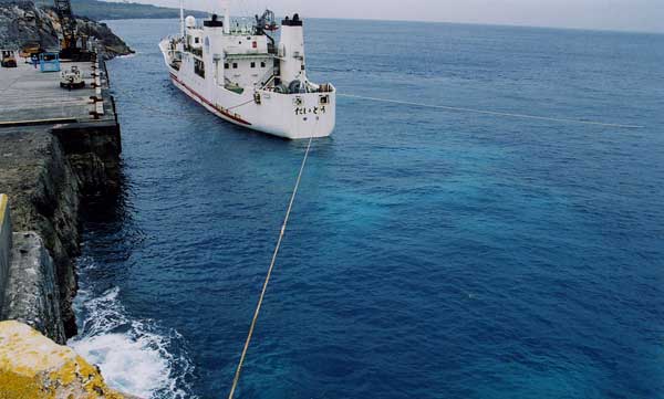
This island lokates 200nm east from Okinawa.
The Daito-maru is the only ship connection between the island and okinawa.
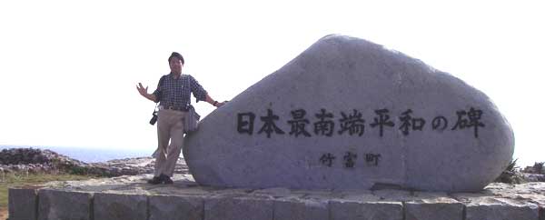

Yonaguni island; west-most point of Japan.